Haonan Dong 董皓男

I am pursuing an MSc in Geodesy and Geoinformation at the Technical University of Munich (TUM), which I joined in September 2026.

Previously, I was a Mid-Level Technical Engineer at the Laboratory of Artificial Intelligence and Digital Economy (Shenzhen), working on UAV photogrammetry, visual SLAM and GNSS fusion, and large-scale 3D Gaussian Splatting. Before that, I worked as an Algorithm Engineer at XGRIDS on multi-sensor calibration and handheld SLAM.

I received my master's degree in Pattern Recognition and Intelligent Systems and my bachelor's degree in Geodesy and Geomatics Engineering from Wuhan University. During my master's studies, I worked at CVRS under Prof. Jian Yao. In summer 2022, I also worked with Prof. Lingjie Liu on neural surface reconstruction.

My interests include 3D Gaussian Splatting, neural radiance fields (NeRF), multi-view stereo (MVS), structure from motion (SfM), SLAM, and multi-sensor fusion for accurate 3D reconstruction.

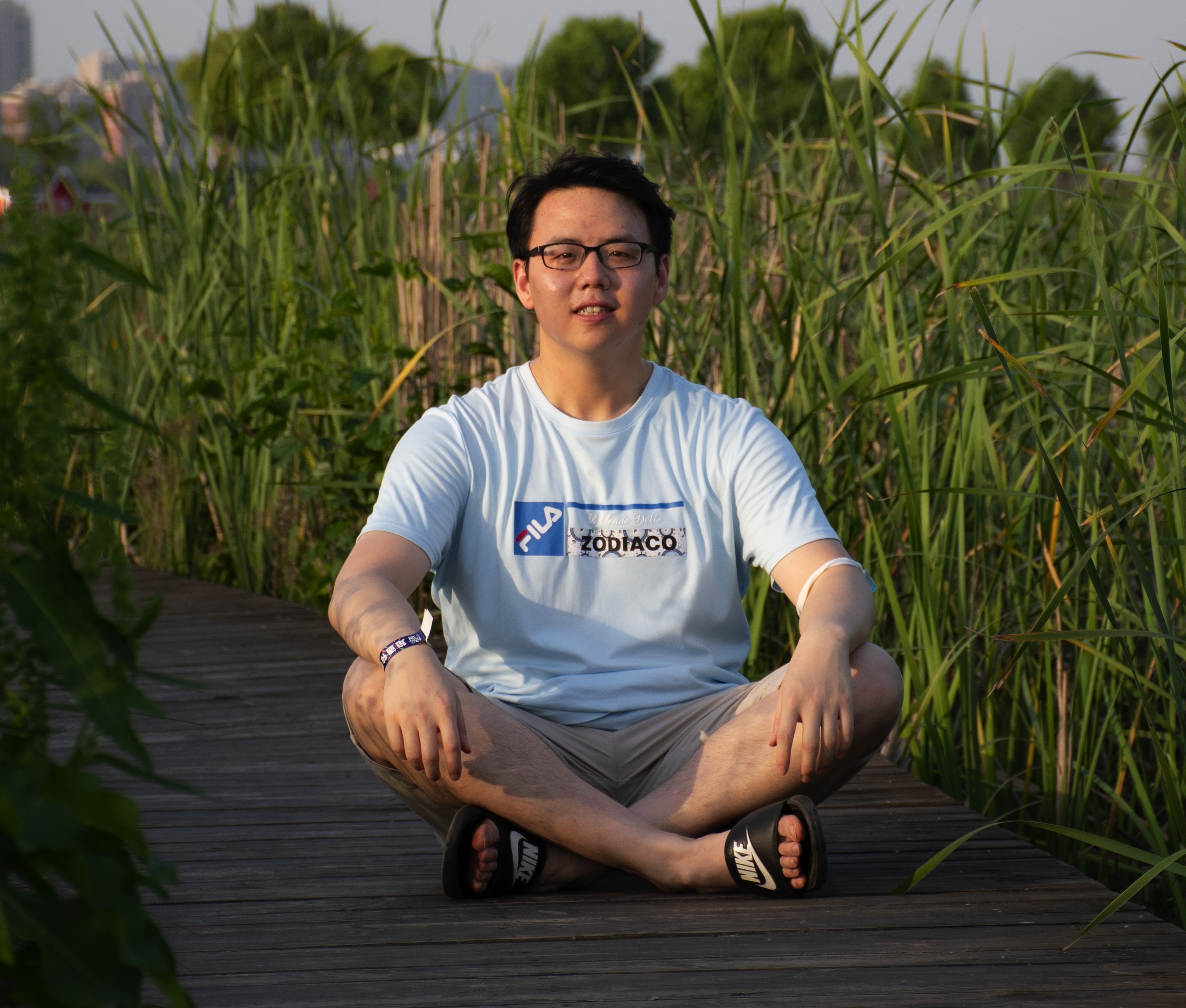
Portrait of Haonan Dong

Work Experience

Laboratory of Artificial Intelligence and Digital Economy (Shenzhen)

Mid-Level Technical Engineer · Shenzhen, China · Sep 2024 – Sep 2026

  • Developed UAV photogrammetric path planning supporting nadir, oblique, and optimized viewpoints for high-precision aerial data acquisition.
  • Integrated visual SLAM and GNSS for accurate real-time orthophoto rectification.
  • Developed a large-scale 3D Gaussian Splatting framework with high-precision reconstruction and distributed training for urban-scale scenes.

Shenzhen Xgrids Innovation Technology Co., Ltd.

Algorithm Engineer · Shenzhen, China · Jun 2023 – Aug 2024

  • Developed intrinsic and extrinsic calibration modules for LiDAR, IMU, and camera systems.
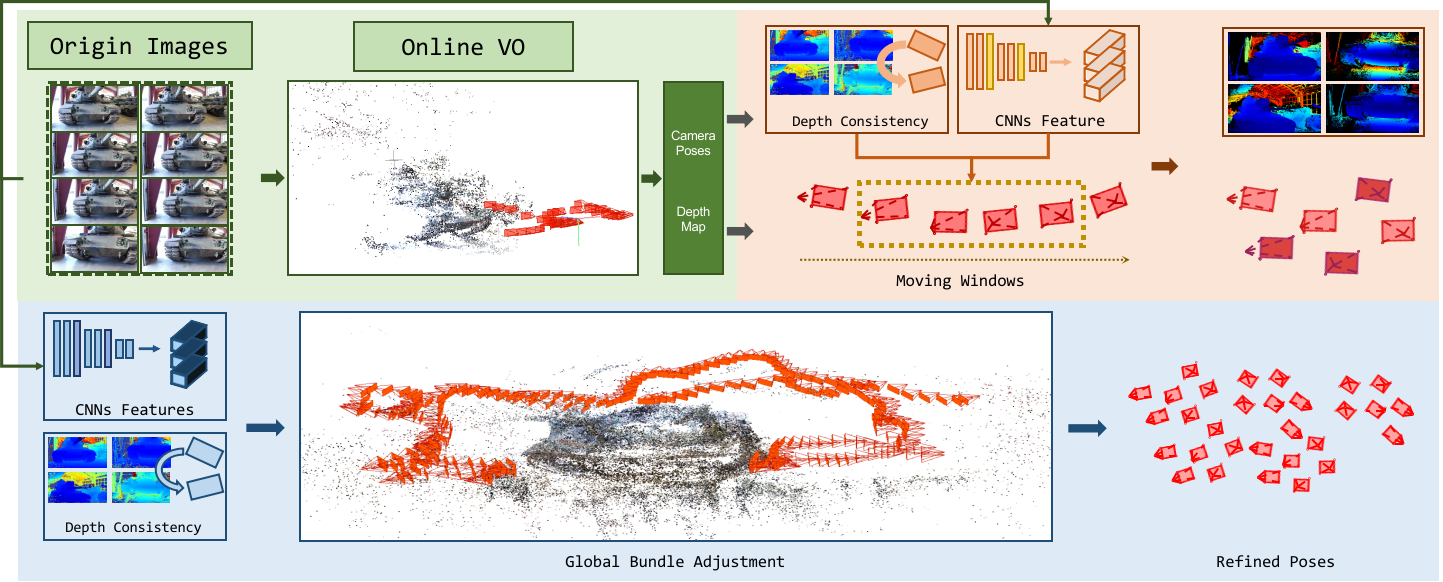
  • Designed and optimized visual modules for handheld SLAM, improving robustness and reconstruction quality.

Education

Technical University of Munich

MSc, Geodesy and Geoinformation · Sep 2026 – Present

Wuhan University

MEng, Pattern Recognition and Intelligent Systems · Aug 2020 – May 2023

University of California, Santa Barbara

Undergraduate Exchange Program, Computer Science · Aug – Nov 2019

Wuhan University

BEng, Geodesy and Geomatics Engineering · Aug 2016 – May 2020

Publications

Research in 3D reconstruction, photogrammetry, and camera calibration. Representative work is highlighted.

Large-Scale 3D Gaussian Splatting Based on UAV Multi-Modal Platform

Haonan Dong, Zhijun Wang, Qingyun Song, Yuhan Tian, Ryan Ge

Japan Society for Photogrammetry and Remote Sensing, Fall Academic Conference, 2025, pp. 25–28.

Oral presentation on November 20, 2025, in Yamagata, Japan. Supported by the ZTE Industry–Academia Collaboration Fund Project.
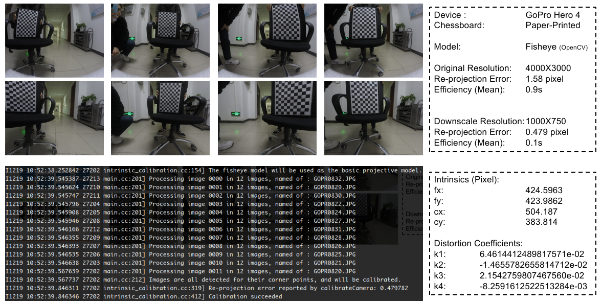
Fisheye calibration research illustration

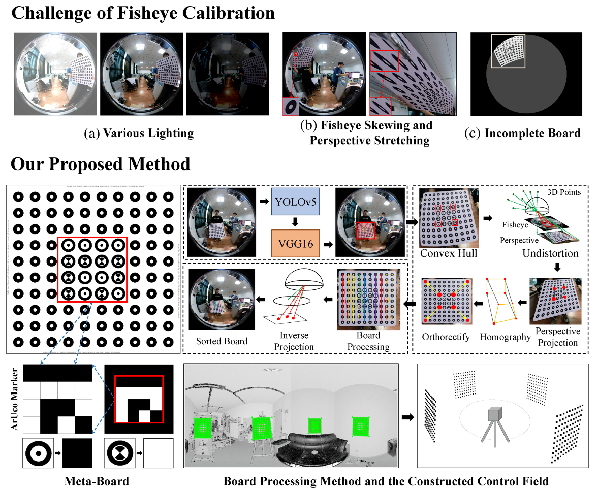
Learning-Based Encoded Target Detection on Iteratively Orthorectified Images for Accurate Fisheye Calibration

Haonan Dong, Jian Yao, Ye Gong, Li Li, Shaosheng Cao, Yuxuan Li

The Photogrammetric Record, 38(183), 297–319, 2023.
Paper

Encoded target detection and iterative orthorectification for accurate fisheye camera calibration. Industry–university collaboration with DiDi Global.
Structure from motion research illustration

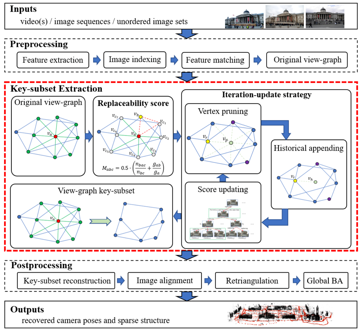
View-Graph Key-Subset Extraction for Efficient and Robust Structure From Motion

Ye Gong, Pengwei Zhou, Yuyue Liu, Haonan Dong, Li Li, Jian Yao

The Photogrammetric Record, 38(183), 252–296, 2023.
Paper

View-graph key-subset extraction to address data redundancy and uneven distribution in SfM. University–enterprise collaboration with Huawei.
PatchMVSNet surface reconstruction results

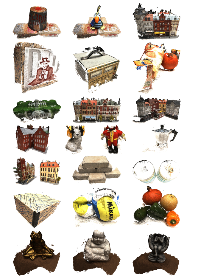
PatchMVSNet: Patch-wise Unsupervised Multi-View Stereo for Weakly-Textured Surface Reconstruction

Haonan Dong, Jian Yao

arXiv preprint, 2022.
Paper

Robust unsupervised learning losses for multi-view stereo and weakly textured surface reconstruction.
Indoor fire evacuation path planning illustration

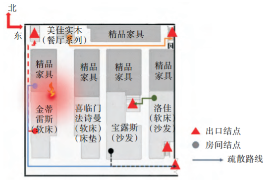
Emergency Evacuation Path Planning Algorithm for Indoor Fire in Commercial Buildings

Haonan Dong, Xiaotong Ye, Congpu Hao

Journal of Geomatics, 46(Sup. 1), 40–43, 2021. (In Chinese)
Paper

Indoor evacuation planning that prioritizes rooms near the fire origin and reduces congestion. Supported by the National Undergraduate Innovation Project.
Selected Projects

Large-Scale Scene Reconstruction Based on Multi-Modal Fusion

Module Leader · ZTE Industry–Academia Collaboration Fund Project · Jul 2025 – Sep 2026

Large-scale scene reconstruction using multi-modal fusion and 3D Gaussian Splatting.

Multi-Sensor Fusion Algorithm Development

Module Leader · XGRIDS · Jun 2023 – Aug 2024

Multi-sensor calibration and visual algorithms for handheld SLAM systems.

RGB-D indoor reconstruction results

High-Accuracy RGB-D Indoor Scene Reconstruction

Project Leader · Collaboration with Huawei · Feb 2022 – Apr 2023

Joint optimization of RGB-D depth and camera poses to reconstruct high-quality indoor models with lightweight hardware.

Multi-camera calibration setup

Calibration of Multi-Camera Systems for Autonomous Vehicles

Project Leader · Collaboration with DiDi Global · Nov 2021 – May 2022

Intrinsic and extrinsic calibration for multi-camera systems, including pinhole, fisheye, monocular, and stereo configurations.

Indoor Fire Evacuation System Based on Wireless Sensor Networks

Project Leader · National Undergraduate Innovation Project · Apr 2018 – May 2019

Earlier Research Projects

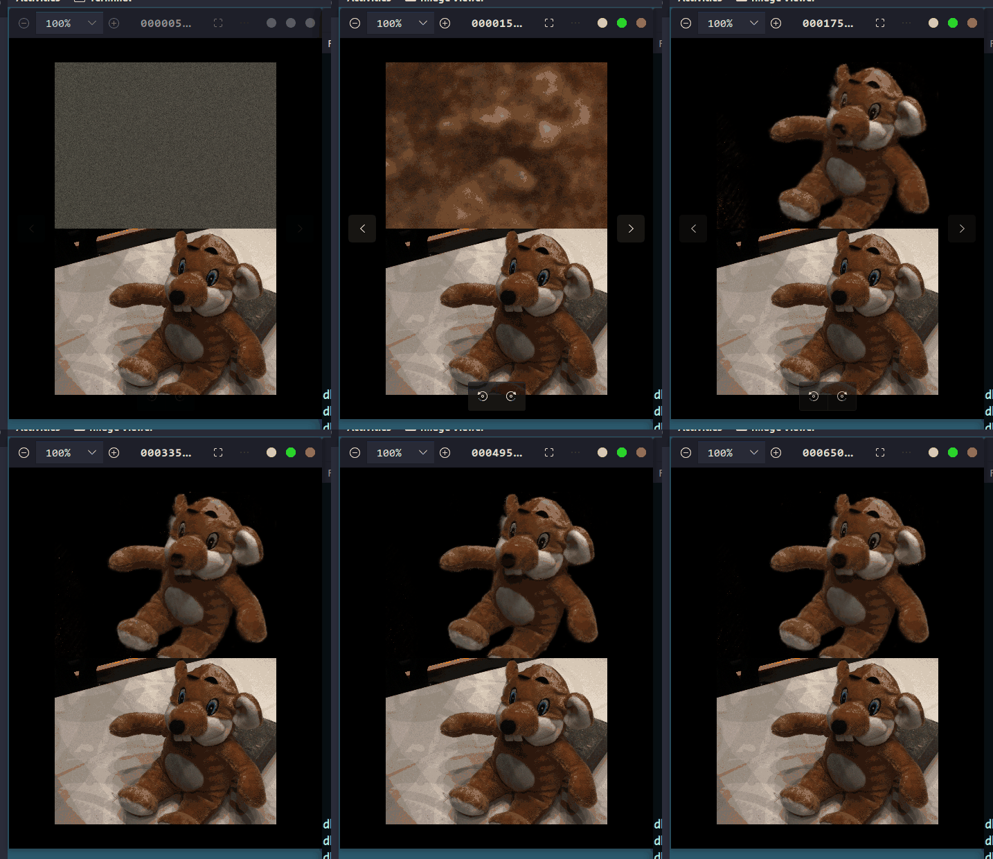
Animated neural surface reconstruction

Instant Neural Implicit Field Surface Reconstruction

Summer internship with Lingjie Liu · 2022

Integrated NeuS into the instant-ngp framework, achieving a 6× speedup over the official implementation.

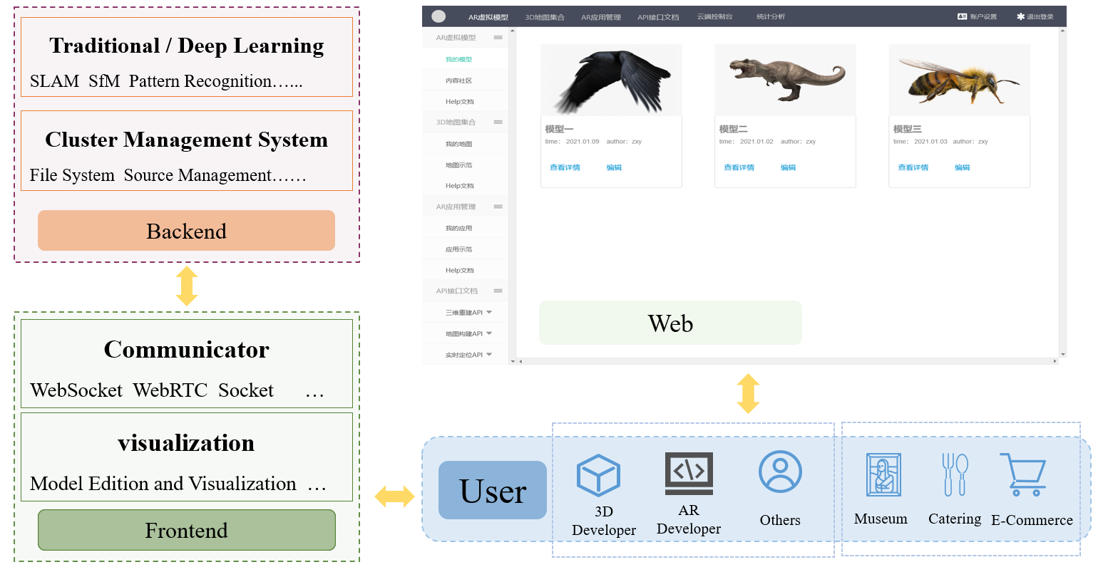
3D reconstruction computing cluster

Online 3D Reconstruction with a High-Performance Computing Cluster

With Hongche Yin, Lei Luo, Han Fang, and Jian Yao.

A reconstruction pipeline producing depth maps and textured meshes from multi-view images or videos.

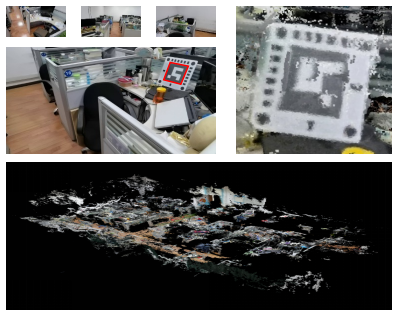
Real-scale map for augmented reality

Real-Scale Maps for AR Based on Structure from Motion

With Hongche Yin, Lei Luo, and Jian Yao.

Recovered real-scale sparse maps using printed ArUco markers and bundle adjustment for augmented reality applications.

Patents

Patent application numbers listed in my CV.

Honours & Qualifications

Languages: English — C1 in listening, reading, speaking, and writing.

Academic Service

Paper reviewer: IROS 2022, ISPRS.

Open Source

RGB 3D Reconstruction Pipeline — Reconstruct textured meshes from videos or RGB image sequences.

Depth Fusion — Fuse depth maps from multi-view stereo or sensors with known poses.

Awesome Indoor Reconstruction — A curated list of indoor reconstruction methods and datasets.